
Reviewed · SKELLIG COAST & ISLANDS TRIPS
Historical Walking Tours in Valentia and the Skellig Region
Bray Head turns history into a walk. This 3-hour Valentia experience links Neolithic sites to Napoleonic-era remains, while you enjoy big, clean views over the Skelligs, the Atlantic, Portmagee, and Valentia Harbour. I especially like how the story is paced by what you can see, not just dates on a page.
The second thing I like is the mix of places, standing stones, ancient field enclosures, the ruins of Crompeol village, monastic huts with stone carvings, and a Napoleonic signal tower. One drawback to flag up front, you need good shoes because some steep walking is involved, and it’s best done in weather that cooperates.
In This Review
- Key highlights you will remember
- Where Bray Head connects the Atlantic to thousands of years
- Foilhommerum Bay: the transatlantic cable landing and a Cromwellian fort
- Bray Head climb: standing stones, ancient field enclosures, and time passing on foot
- Crompeol village ruins: Gaelic settlement you can actually picture
- Monastic huts and stone carvings: the small details that change the mood
- Napoleonic signal tower: why this place mattered later
- Views that do the talking: Skelligs, Portmagee, and Valentia Harbour
- Guide quality: what you get from A Sense of Place
- Timing, duration, and what 3 hours really covers
- Price and value: $57.84 for a guided timeline with free entry
- What to bring so the walk stays fun
- Who should book this Valentia and Skellig Region walk
- Should you book this historical walking tour?
- FAQ
- Where does the tour start?
- How long is the tour?
- Is the tour a private experience?
- What historical areas will I see on the walk?
- What views can I expect during the walk?
- Is there steep walking?
- What should I wear or bring?
- Are service animals allowed?
- What time does the tour operate?
- Is it okay to book if the weather turns bad?
- Is it worth booking last minute?
Key highlights you will remember
- Foilhommerum Bay history, where the first transatlantic cable reached Valentia and you can also link it to a Cromwellian fort from the 1650s
- Bray Head viewpoints that keep the Skelligs and Atlantic in your line of sight as the walk climbs
- Crompeol village ruins, a chance to see how Gaelic settlement life left marks you can still trace
- Monastic huts with stone carvings, small, specific details that feel tangible when you stand right beside them
- Napoleonic signal tower, a later chapter that shows the area mattered long after older communities were gone
- Local historian leadership, with at least one guide named Eion noted for flexibility and solid area knowledge
Where Bray Head connects the Atlantic to thousands of years
This walk is built around a simple idea: you start down near Bray Head Car Park, then you follow the track upward and you keep turning your head to read the coast and the ground at the same time. At the start, you’re looking out toward Foilhommerum Bay, which helps the whole experience click. It is hard to separate the human story from the ocean here, because the sea is part of why these places mattered.
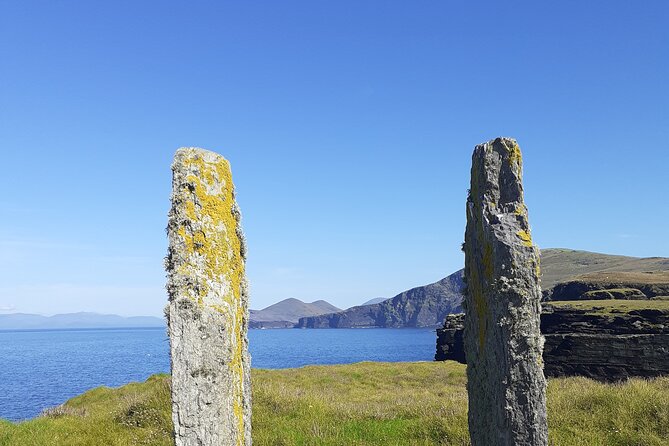
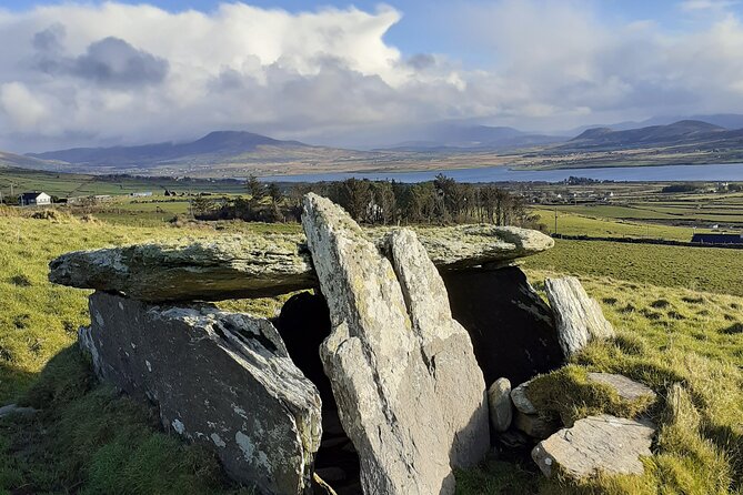
From there, the route climbs toward Bray Head. Along the way, you will pass features that span a long timeline, standing stones, ancient field enclosures, and village and religious remains. Instead of treating each site like a postcard, the guide ties them together as a sequence, from older settlement patterns through later periods when the area became strategic.
The real value is that you are not just sightseeing. You are learning how people used this corner of Kerry, and why the views from the top were useful.
Foilhommerum Bay: the transatlantic cable landing and a Cromwellian fort
The walk begins with your eyes on the coast, and that matters. Foilhommerum Bay is where the first transatlantic cable came ashore in Valentia. Even if you know the broad idea of early underwater communication, standing in the area that received the cable turns the concept into something physical and local.
Right near this coastal story is another historical thread, a Cromwellian fort built in the 1650s. That combination is the kind of thing I love in places like Valentia. It is a reminder that this region was not only about early communities and rituals, it also became a defensive and communication point as time moved on.
If you are the type of traveler who likes a clear through-line, you will appreciate how the guide uses these anchor points. You can connect the bay to later field work and village remains as the walk progresses.
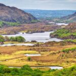
More beehive huts off the far coast:

Bray Head climb: standing stones, ancient field enclosures, and time passing on foot
As you follow the track up Bray Head, the scenery stays tied to the Skelligs and the Atlantic. That is more than a nice view. It helps you understand why certain areas were settled, monitored, or used. When you are higher up, you can see lines of sight and the scale of the coast, and it makes the story feel grounded.
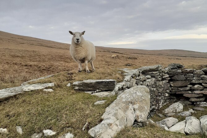
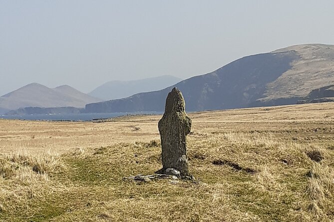
On the way, you will encounter standing stones and ancient field enclosures. These are not polished ruins. They are the kind of features that reward slow walking and careful looking. The carvings and edges are easier to miss if you hurry. With a guide, you get prompted to notice what the eye might skip on its own.
One practical tip: wear footwear that grips well on uneven ground, because the walk is part climb. If you slip, you lose the chance to focus on the details, and the entire point of this tour is seeing the details.
Crompeol village ruins: Gaelic settlement you can actually picture
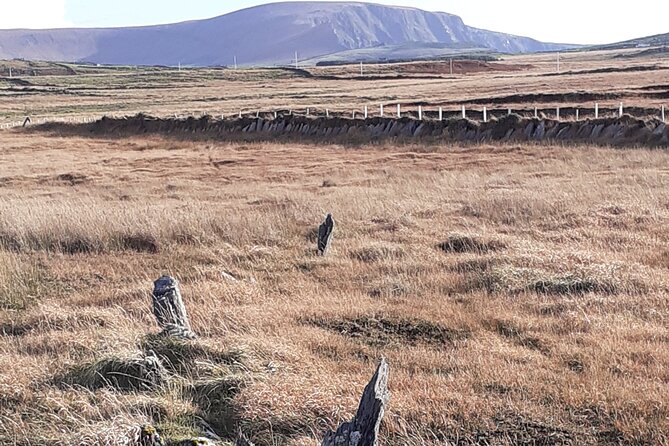
You will visit the ruined Gaelic village of Crompeol, and this is where the walk starts to feel like daily life instead of only big historical events. Village ruins are different from monastic remains or towers. They have a scattered, human scale that makes you think about movement, work, and weather.
What makes Crompeol especially interesting for a walking tour is that you can relate it to the surrounding features you have already seen, standing stones and field boundaries. The guide helps you connect the idea of land use with settlement patterns, so it does not feel like random stones placed for decoration.
If your travel style is “show me what people did here,” you will likely enjoy this segment most. It gives you a clearer picture of how communities lived before later changes reshaped the area.
More Irish streets taken slow:
- Guided Killarney National Park Walking Tour
★ 5.0 · 377 reviews - Killarney: Gap of Dunloe Walking and Boat Tour
★ 4.4 · 72 reviews - Boat Only Ticket (Walk the Gap of Dunloe)
★ 4.5 · 57 reviews - Sneem Waterfall and Eagles Lake Guided Walk
★ 5.0 · 15 reviews
Monastic huts and stone carvings: the small details that change the mood
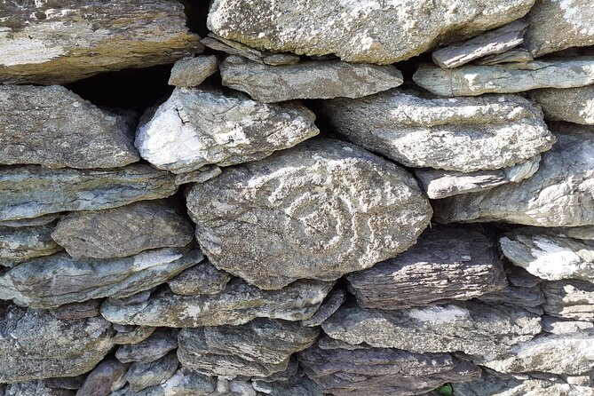
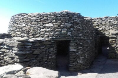
Next comes a quieter, more intimate part of the story: monastic huts with stone carvings. This is not just a stop where you stand and take a photo. It is the kind of place where you slow down naturally, because the carvings are specific and your brain shifts into observation mode.
Stone carvings can be tricky from a distance. From what you will be guided to look for, the carvings become a way to talk about belief, learning, and craft. It is also where the timeline feels real, because you are moving from older open-air markers into a space where people worked on permanence.
Bring attention here. If you only skim, you will miss the value. Give yourself a moment to look closely at what the guide points out, then look again without help. That second look is where it starts to sink in.
Napoleonic signal tower: why this place mattered later
After the older layers and village remnants, the route brings you to the signal tower from the Napoleonic period. This is a satisfying shift because it shows the area’s importance was not a one-time story. Long after the earlier communities left their marks, this part of Valentia still mattered.
A signal tower makes you think about communication and watchfulness, not just residence. Pair it with the earlier clue at Foilhommerum Bay, the first transatlantic cable, and you get a theme you can carry through the walk: information traveling across distance. One is cutting-edge technology for its time, the other is a visual system that depends on line of sight and weather.
When you reach this point, you will understand why Bray Head views are part of the history lesson. From higher ground, you can see farther, and that changes the story from “what happened” to “how people responded.”
Views that do the talking: Skelligs, Portmagee, and Valentia Harbour
I like tours where the views are not an afterthought. Here, the guide keeps connecting the scenery to what you are seeing on the ground. You will have moments to take in the Skelligs, the Atlantic, Portmagee, and the entrance to Valentia Harbour.
Even if fog or low cloud softens the distance, the coast still helps you understand orientation. You will get a better sense of where the cable came ashore, where ships would move, and why a headland would be worth walking.
If your goal is photos, you will still get them. But the better win is mental mapping. After this walk, you tend to feel less lost when you explore on your own.
Guide quality: what you get from A Sense of Place
This experience is led by a local historian experienced with historical walks around Valentia and South Kerry. The tone tends to be practical, with attention to what you are looking at right then.
One guide named Eion has been specifically praised for being both knowledgeable about the area and flexible with the schedule. That kind of leadership matters on a walk like this, because weather and footing can change fast near the coast.
So here is the practical approach: arrive ready to enjoy, then trust the guide to adjust the pacing. If you have mobility limits, it is worth saying so early, because the tour includes some steep walking and you will want the best possible route on the day.
Timing, duration, and what 3 hours really covers
The walk is listed at about 3 hours, and that time window works well for this kind of layered outing. You get enough time to climb, stop, look, and still have energy to keep enjoying the rest of your Ring of Kerry or Valentia plans.
Tours run in a window shown as 10:00 AM to 5:00 PM, with the schedule valid across the season dates listed. Exact departure times likely vary by day, but the key is you should plan to be at the start and ready to walk within those daytime hours.
Also, this is described as a private tour/activity, meaning only your group participates. That generally helps with pace. If you want questions answered and you do not want to hear someone else’s conversation for the whole climb, this format is a plus.
Price and value: $57.84 for a guided timeline with free entry
At $57.84 per person, this is not the cheapest way to stretch your legs in Kerry, but it can be good value if you want real context. The price buys you a local historian, a structured route, and guided interpretation of multiple historical features in one outing.
There is also a note that the admission ticket is free, which is helpful. You should still expect to spend money on your general day costs, but you likely will not have extra site fees stacking up on top of the tour price.
The best value tends to come when you care about understanding what you are seeing. If you prefer to roam without explanations, you might feel the price more. If you like guided learning and you want someone to point out the carvings and the meaning behind the stones, this hits the sweet spot.
If you can, book ahead. The average booking time is noted as about 16 days in advance, which is a good sign that popular times can fill.
What to bring so the walk stays fun
The tour is weather dependent and you are asked to bring rain gear and good shoes or boots. That is exactly what you should do, especially near coastal headlands where conditions shift.
A few practical basics:
- Wear shoes that handle uneven ground and possible slick patches
- Bring a rain layer, even if the morning looks fine
- Expect some steep walking, plan your pace and take breaks when the guide suggests
If the day turns wet and windy, do not fight it. Put comfort first. When you feel steady on your feet, you will enjoy the history instead of just surviving the climb.
Who should book this Valentia and Skellig Region walk
This is a great fit if you want a guided way to connect multiple eras in a single outing. It works well for history lovers who also like scenery, and for travelers who enjoy walking as a learning tool.
You might especially enjoy it if you are:
- Doing the Ring of Kerry and want one structured, meaningful half-day element in Valentia
- Interested in how communication and strategy shaped places like Foilhommerum Bay
- Curious about Gaelic village remains and monastic stone carvings, not just towers and big monuments
If you are very sensitive to slopes or rough footing, consider the steep walking note carefully. The tour says most travelers can participate, but you should take the terrain seriously.
Should you book this historical walking tour?
I’d book it if you want a guided route that turns visible ruins into a clear timeline. It is hard to beat the combination of Skellig and Atlantic views with stops that span neolithic markers, Gaelic village remains at Crompeol, monastic carvings, and a Napoleonic signal tower.
I would not book it if you expect flat, easy walking or if you want a purely casual stroll with no interpretation. This one asks you to walk a bit and pay attention, and the reward is a smarter way to understand Valentia.
If you line it up with a day when the weather is stable, and you show up in boots you trust, this is the kind of tour that makes you feel like the place finally makes sense.
FAQ
Where does the tour start?
It starts at Bray Head Car Park on Unnamed Rd, Co., Bray, Co. Kerry, Ireland.
How long is the tour?
The duration is about 3 hours.
Is the tour a private experience?
Yes. Only your group participates.
What historical areas will I see on the walk?
You will see standing stones, ancient field enclosures, the ruined Gaelic village of Crompeol, monastic huts with stone carvings, and a Napoleonic-period signal tower, plus viewpoints over Foilhommerum Bay and Valentia Harbour.
What views can I expect during the walk?
You can look out toward the Skelligs, the Atlantic, Portmagee, and the entrance to Valentia Harbour.
Is there steep walking?
Some steep walking is necessary.
What should I wear or bring?
Bring rain gear and good shoes or boots.
Are service animals allowed?
Yes, service animals are allowed.
What time does the tour operate?
The provided hours are Monday through Sunday, 10:00 AM to 5:00 PM, within the listed season dates.
Is it okay to book if the weather turns bad?
This experience requires good weather. If it is canceled due to poor weather, you will be offered a different date or a full refund.
Is it worth booking last minute?
There is an average booking window of about 16 days in advance, so planning ahead can help you get the time you want.
Rebellions Retold
- Innisfallen Island – Scenery & history of Killarney National Park
★ 5.0 · 66 reviews - Full Day Private Cultural Tour in Dingle Peninsula
★ 5.0 · 31 reviews - Dublin Historical Centre Food Tour with 8 Food Tastings & Drinks
★ 5.0 · 1,718 reviews - 2-Hour Historical Walking Tour from Dublin
★ 5.0 · 875 reviews
Latest to join the session in Killarney
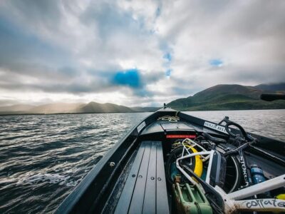

Skellig Coast & Islands Trips, compared.
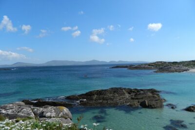
Skellig Michael : Ultimate Skellig Coast Tour with AquaTerra
Read our review →
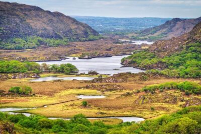
Ring of Kerry: Portmagee and Skellig Ring Tour from Killarney
Read our review →
Luxury Photography Day Tour on Ring of Kerry and Skellig Ring – Fully Guided and Chauffeured
Read our review →
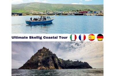
Skellig Michael: Skellig Sightseeing Cruise with AquaTerra
Read our review →Browse the lists this tour appears in